Jul 1, 2012
PROJECT PORTAL This project helped a small NH coastal community (Newfields) with a volunteer-board government move climate preparedness from concern to action by using the NOAA Roadmap for Adapting to Coastal Risks (NOAA Roadmap). The Roadmap is a community-driven...
Feb 1, 2012
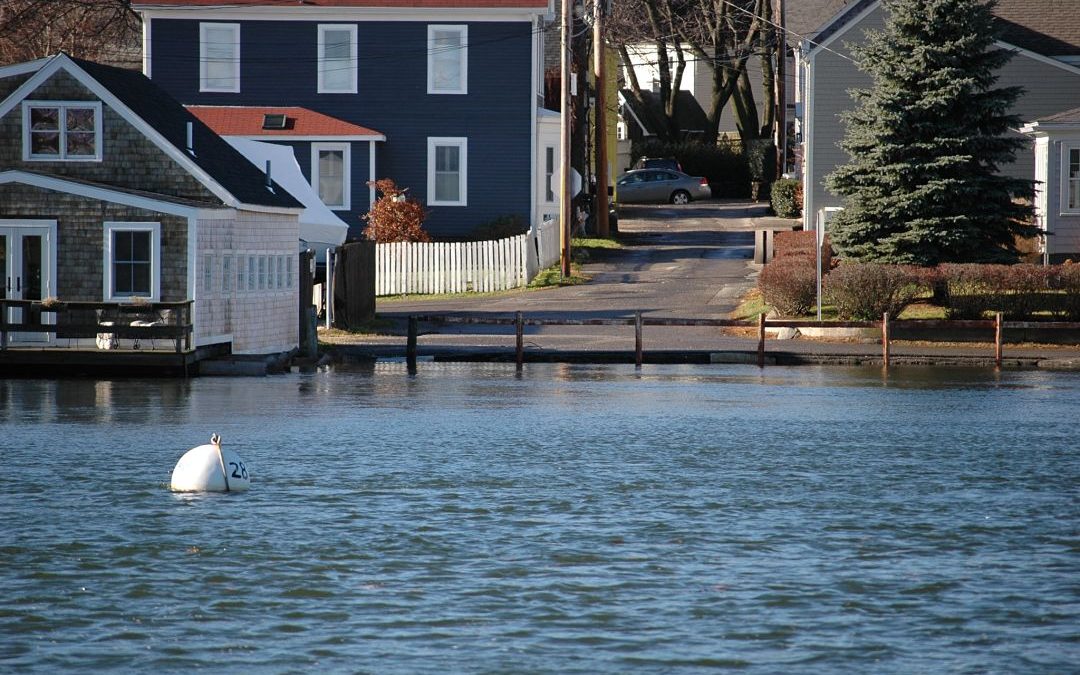
Project Portal An empirical relationship exists between storm tide, waves and coastal flooding or splash-over damage (NWS coastal flood study). Knowing this relationship helps predict when flooding and splash-over events (such as beach erosion) might occur based on...
Sep 13, 2011
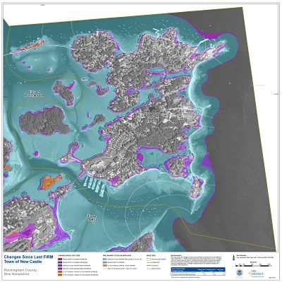
Project Portal The objective of this project is to produce a suite of non-regulatory, Risk MAP products to accompany the updated floodplain maps for the NH Coastal Mapping project. Collectively, they extend the utility of the maps and reports, encourage community...
Sep 1, 2011
Project Portal This project included three components: 1) Research and documentation of the best practice/innovative municipal adaptation approaches in the Northeast; 2) Municipal technical assistance through a small grant program; and 3) Adaptation/resilience...
Mar 1, 2011
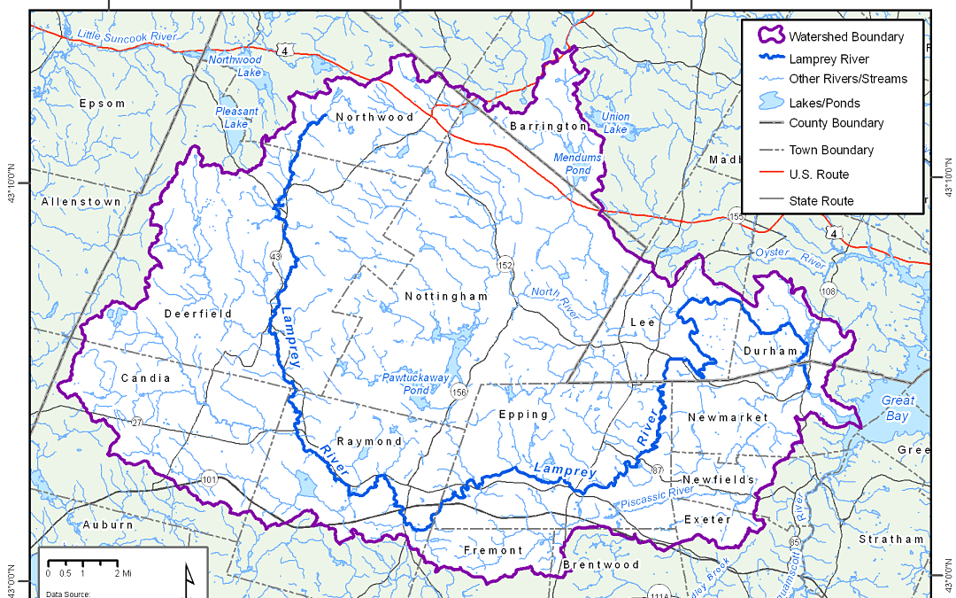
Project Portal This project assessed various types of legal risks communities in the Lamprey River Watershed may be concerned about as a result of adopting new flood management regulations and policies. To assess these risks we identified four potential legal...