PROJECT PORTAL
Using Science, Building Social Capital, and Unpacking Tax Incentives for a Resilient Coastal New Hampshire (SUSTAIN NH)
The SUSTAIN NH Project of Special Merit sought to:
- Update best available coastal flood risk science and enable its use in decision-making;
- Build social capital in vulnerable coastal communities through creative outreach and engagement; and
- Inform future implementation of Senate Bill 185 (2017), which extends the Community Revitalization Tax Relief Program (RSA 79-E) to coastal properties subject to coastal flooding.
Funded project partners included the: New Hampshire Department of Environmental Services (NHDES) Coastal Program (NHCP); Rockingham Planning Commission (RPC); Strafford Regional Planning Commission (SRPC); Studio NaCl; University of New Hampshire (UNH); and UNH Cooperative Extension (UNHCE) / New Hampshire Sea Grant (NHSG).
Major project outcomes are summarized below.
Project Lead
Funding
Time Frame
Start: October 1, 2018
End: March 31, 2020
Invisible
Updated Coastal Flood Risk Science and Guidance
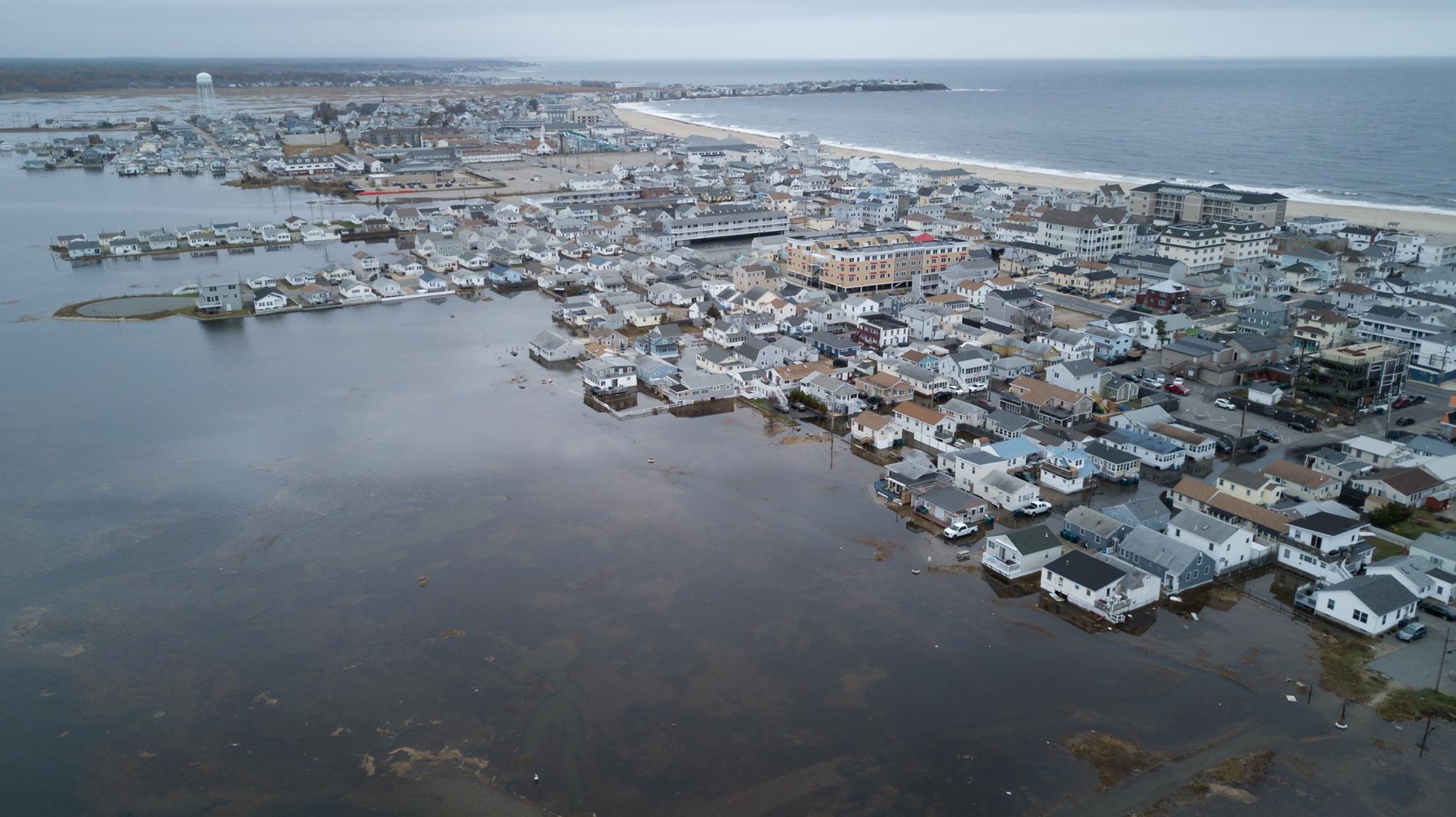
Beginning in November 2018, the NHCP convened a Science and Technical Advisory Panel (STAP) comprised of representatives from the New Hampshire Department of Transportation, Division of Homeland Security and Emergency Management, Office of Strategic Initiatives, Fish and Game Department, Department of Natural and Cultural Resources, Department of Administrative Services, RPC, SRPC, UNH, coastal municipalities, and New Hampshire Coastal Adaptation Workgroup to oversee and contribute to the development of the 2019-2020 New Hampshire Coastal Flood Risk Summary. The 2019-2020 New Hampshire Coastal Flood Risk Summary is comprised of two parts, including Part I: Science and Part II: Guidance for Using Scientific Projections. Together, Part I and Part II of the New Hampshire Coastal Flood Risk Summary fulfill the requirements of RSA 483-B:22, which directs NHDES to supervise updates to the 2014 Coastal Risk and Hazard Commission Science and Technical Advisory Panel report, Sea-Level Rise, Storm Surges, and Extreme Precipitation in Coastal New Hampshire, Analysis of Past and Projected Trends, at least every five years.
NH Coastal Flood Risk Summary, Part I: Science
Published in August 2019, Part I: Science provides a synthesis of the state of the science relevant to coastal flood risks in New Hampshire and includes updated projections of relative sea-level rise, coastal storms, groundwater rise, precipitation and freshwater flooding. Part I: Science was developed by a team of scientific advisors from the UNH and was reviewed by the STAP and an external panel of regional climate experts from the Northeast Regional Climate Center at Cornell University, Massachusetts Institute of Technology, Purdue University, Rutgers University, U.S. Geological Survey, HydroAnalysis, Inc., and the National Oceanic and Atmospheric Administration. Final design and formatting was done by Studio NaCl.
NH Coastal Flood Risk Summary, Part II: Guidance for Using Scientific Projections
Published in March 2020, Part II: Guidance for Using Scientific Projections provides science-based and user-informed guiding principles and a step-by-step approach for incorporating the updated coastal flood risk projections from Part I: Science into private, local, state, and federal projects, including planning, regulatory, and site-specific efforts. Part II: Guidance for Using Scientific Projections also includes case studies demonstrating how coastal flood risk information has been used to date in coastal NH decision-making, including: 1) incorporating sea-level rise into the Lubberland Creek culvert replacement design and construction; 2) amending Durham, NH flood hazard overlay district to include advisory climate change risk areas vulnerable to 3.9 feet of sea-level rise plus storm surge; 3) mapping changing wetlands in Portsmouth, NH due to sea-level rise induced groundwater rise; 4) revising state Alteration of Terrain rules to require applicants to account for a 15% increase in extreme precipitation estimates in stormwater drainage analyses; 5) and mapping future potential flood inundation depth and extent for the projected (2050) 1% annual chance flood event in Lee, NH. Part II: Guidance for Using Scientific Projections was prepared in partnership with the STAP, UNH, and NHDES and underwent public review throughout September 2019. Final design and formatting was done by Studio NaCl. The NHCP ordered 500 print copies to be distributed in accordance with the requirements of RSA 483-B:22.
NH Sea-level rise, storm surge, and groundwater rise mapper
As part of the 2019-2020 NH Coastal Flood Risk Summary effort, the NHCP launched the NH Sea-Level Rise, Storm Surge, and Groundwater Rise Mapper (NH SLR Mapper) in order to provide easy access to future coastal inundation information, including mapped sea-level rise and sea-level rise plus storm surge scenarios, as well as new sea-level rise induced groundwater rise zone maps developed and published by UNH as part of the SUSTAIN NH project. The NH SLR Mapper is intended to be a screening tool used by state and local policy makers, land use decision-makers, and coastal residents for planning purposes only.
virtual webinar trainings
In partnership with the Piscataqua Region Estuaries Partnership (PREP), the NHCP and UNHCE/NHSG hosted two webinar trainings on the 2019-2020 NH Coastal Flood Risk Summary on March 30 and 31, 2020. Links to the webinar slides and recordings, as well as written responses to questions asked during the webinars are available here. Over 60 participants joined the webinars, including private consultants, municipal staff and board members, state agency staff, interested community members, and others from 20 different NH municipalities and 6 other states. Over 90% of people who filled out an evaluation survey after the webinars said that they plan to or may use Part II: Guidance for Using Scientific Projections to help clients make informed decisions, inform land use regulation amendments, and incorporate best-available science into design and construction.
Creative strategies to build social capital for resilience
The SUSTAIN NH project enabled the NHCP and UNHCE/NHSG to develop a Creative Outreach Plan for coastal community Resilience (COPR) for the NH Coastal Adaptation Workgroup (CAW); pilot a citizen science approach for collecting coastal flooding data during king tide events, and carry out CAW’s 2019 King Tide Photo Contest with a new focus of engaging local board and commission members.
Creative outreach plan for coastal community resilience (copr)
The UNHCE/NHSG developed a COPR in order to help CAW move beyond its traditional community engagement methods and reach broader, more diverse, and more socially vulnerable audiences. The COPR explores the role of social cohesion/capital in climate adaptation and characteristics of equitable adaptation, summarizes social vulnerability information for coastal NH communities, and outlines creative outreach and engagement strategies for the CAW Outreach Subcommittee to consider using in the future in order to build social capital in vulnerable coastal communities.
king tide volunteer mapping pilot project
The UNHCE/NHSG received funding to pilot a “Catch the King” citizen science project in coastal New Hampshire to collect real-time flooding data during a projected king tide on Oct. 27-30, 2019. A total of 2,512 data points were collected by 8 volunteer teams over the 4-day sampling period. This data helps identify potential flooding hotspots and may help improve decision-making for coastal towns. A more detailed overview and summary of project findings is provided in the “Catch the King” final report.
2019 nhcaw king tide photo contest
The NHCP and UNHCE/NHSG supported the CAW Social Media Team in planning and carrying out the #KingTideNH2019 Photo Contest on October 27-30, 2019 in order to raise awareness of NH’s rising tides. In preparation for the contest, staff updated contest rules, secured prizes from seacoast area businesses, and published over 50 promotional posts on social media. A panel of local judges met on November 1, 2019 to select the Most Vulnerable, Most Resilient, and Best Halloween Theme category winners from over 160 submissions. Members of the public were also invited to vote for the People’s Choice winner. Following the contest, the NHCP published a blog post announcing contest winners, secured donated prints of select contest photos, and organized several exhibits throughout the seacoast, including a creative outreach event entitled, “A perspective on New Hampshire’s King Tides and Climate Change Outlook from a Hurricane Maria Responder,” at 3S Artspace in Portsmouth, NH on January 15, 2020. In addition to these exhibits, NHCP compiled contest photo submissions taken in Hampton, NH into an ArcGIS Story Map to share with municipal staff and board and commission members at the Hampton Coastal Hazards and Adaptation Team meeting on April 21, 2020. A final report summarizing contest outreach and participation was presented to the CAW Outreach Subcommittee to inform future contest promotion and engagement efforts.
draft analysis of rsa 79-e:4-a coastal resilience incentive zones
Enacted in 2017, RSA 79-E:4-a extends the community revitalization tax relief incentive program established under RSA 79-E to coastal properties subject to storm surge, sea-level rise, and extreme precipitation. Specifically, the legislation allows municipalities to: 1) establish a Coastal Resilience Incentive Zone (CRIZ); 2) determine qualifying resilience measures eligible for tax relief; 3) provide other relief to properties in a CRIZ that are subject to repeated inundation; and 4) create a non-lapsing CRIZ fund to cover projected municipal costs and support the CRIZ purpose. In order to inform future implementation efforts, the NHCP, RPC, and SRPC proposed to develop and provide coastal municipalities with an informational primer on RSA 79-E:4-a; conduct a preliminary community needs assessment to identify gaps in technical information, potential opportunities and challenges, and other important considerations; and research existing tax relief programs and methods for valuing resilience measures and calculating tax abatements. However, in reviewing the legislation and preparing the draft primer, NHCP, RPC, and SRPC staff encountered several unanswered technical and procedural questions regarding how a municipality would implement a Coastal Resilience Incentive Zone tax relief program. Project staff proceeded to submit a legal inquiry to the New Hampshire Municipal Association and met with their legal services counsel for further clarification. Project staff also met with local tax assessment and planning staff from Dover, Durham, Hampton, and Rye, NH to discuss their perceptions of the viability of RSA 79-E:4-a. Following these conversations, project staff agreed that it was premature to issue a primer on RSA 79-E:4-a and promote the legislation as a viable adaptation tool, as currently written. Instead, the NHCP, RPC, and SRPC decided to synthesize their analysis of RSA 79-E:4-a and have begun drafting a white paper which includes an annotated statute and outlines some of the key implementation challenges and considerations, as well as options for revisiting the legislation in the future. Project staff are committed to finalizing the white paper and sharing their findings with the legislation’s sponsor beyond the conclusion of this grant award.