Project Portal
Hampton NH Tide Gauge Summary
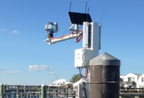
CAW partners released a new report entitled, “A Summary of High Tide Flooding Recorded by the Hampton, New Hampshire Tide Gauge: 2013-2020 ![]() ,” describes the frequency of high tide flooding in Hampton, New Hampshire, based on an analysis of a tide gauge in Hampton Harbor, which was installed in December 2012. The analysis shows that between 2013 and 2020, at least one high tide flood occurred on 36% of all the days recorded by the tide gauge. High tide floods are defined as a high tide reaching above the local high tide flooding threshold of 10 feet referenced to mean lower low water (MLLW). Mean lower low water (MLLW) is the average elevation of the lower of two daily low tides over time. In the low-lying areas of Hampton, floodwaters inundate local roads and property when water levels reach 10 feet above MLLW. The report summarizing the gauge data record was published by the New Hampshire Department of Environmental Services Coastal Program in partnership with NOAA’s Office for Coastal Management and National Weather Service, the Northeast Regional Association of Coastal and Ocean Observing Systems (NERACOOS), Charybdis Group LLC., and the Seabrook Hamptons Estuary Alliance. You can read the NH Department of Environmental Services Press Release about the report at this link.
,” describes the frequency of high tide flooding in Hampton, New Hampshire, based on an analysis of a tide gauge in Hampton Harbor, which was installed in December 2012. The analysis shows that between 2013 and 2020, at least one high tide flood occurred on 36% of all the days recorded by the tide gauge. High tide floods are defined as a high tide reaching above the local high tide flooding threshold of 10 feet referenced to mean lower low water (MLLW). Mean lower low water (MLLW) is the average elevation of the lower of two daily low tides over time. In the low-lying areas of Hampton, floodwaters inundate local roads and property when water levels reach 10 feet above MLLW. The report summarizing the gauge data record was published by the New Hampshire Department of Environmental Services Coastal Program in partnership with NOAA’s Office for Coastal Management and National Weather Service, the Northeast Regional Association of Coastal and Ocean Observing Systems (NERACOOS), Charybdis Group LLC., and the Seabrook Hamptons Estuary Alliance. You can read the NH Department of Environmental Services Press Release about the report at this link.

