Analysis of Flood Damage Cost Avoidance in the Lamprey River Watershed of NH
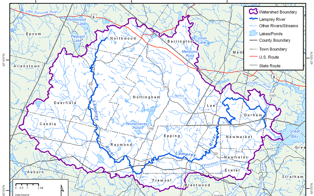
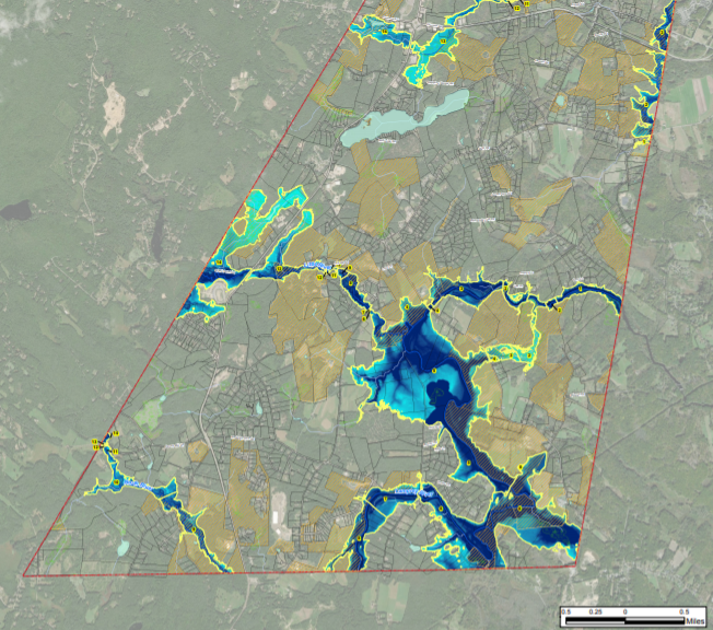
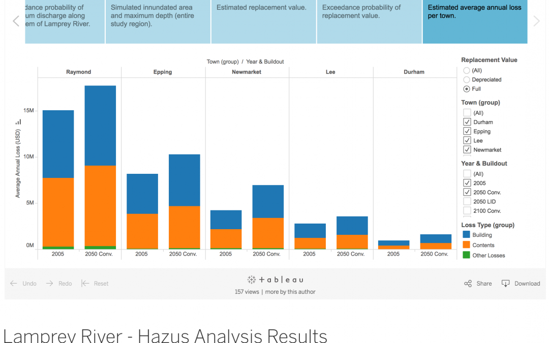
Project Portal The primary purpose of this report was to summarize efforts to estimate potential flood damages and cost avoidance for three communities (Raymond, Epping, and Newmarket) within New Hampshire’s Lamprey River watershed as a result of changes in land use...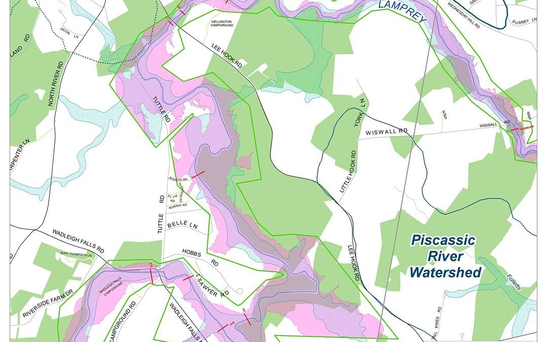
Lee Floodplain Mapping
PROJECT PORTAL SRPC will work with the Lee Conservation Commission, Emergency Management Director, and the Planning and Zoning Department to produce a series of maps with the new floodplain data produced for the Lamprey River Watershed. The maps will be used for land...